
The Milwaukee Road Northern Montana Division route to Great Falls left Lewistown heading west towards Denton MT. I don't have this area in pictures but if you do a web search for Sage Creek and Judith River Trestle, these are the highlights of the line, and also the route the Charlie Russel Chew Choo follows. I will begin at Denton MT and head west towards Great Falls.
Note: The updated pictures begin at the Malmstrom A.F.B. section, so scroll down 75% of the page.

Denton MT yard looking west from the Bain Street crossing. This is the main yard for the Central Montana Railroad, and is the newer light brown building on the right.


CMR's parts loco parked beside a silo in the Denton yard.

Denton Yard looking east.

Denton from the east.

Coffee Creek MT, I noticed the two snowplows and Great Northern passenger car 902
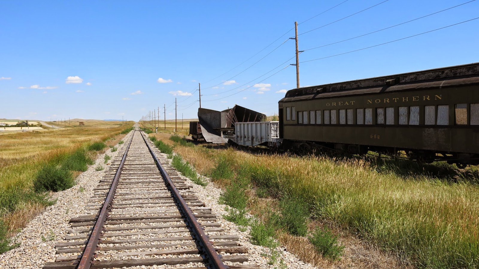


The Northern Montana Division laid rails in 1913-1914. As we can see, this rail is 101 years old, and still in use by the CMR.

These shots were taken will sitting on the South Coffee Creek Road crossing, looking west towards Surprise Creek.

Looking east towards Denton.

Looking east with Square Butte in the distance.


Next up is the settlement of Arrow Creek, which happens to be where the railroad crosses Hwy 80.


Some rather unusual cars location here on the siding. Formerly know as ACF F89-J Flatcar- TTX (JTTX) #601271 is now sitting on a siding at this location. Photo courtesy of BLMA Models
The lower depression flatcar has an unknown history.


The mainline looking east towards Coffee Creek.

Looking west towards Surprise Creek, the track makes a severe left turn as it descends the coulee, then a sharp right hand turn to follow the creek down to Square Butte.


Couldn't help but catch this classic Milwaukee Road switch stand.


A mile north of Square Butte is the Lonetree Stage Road Crossing.
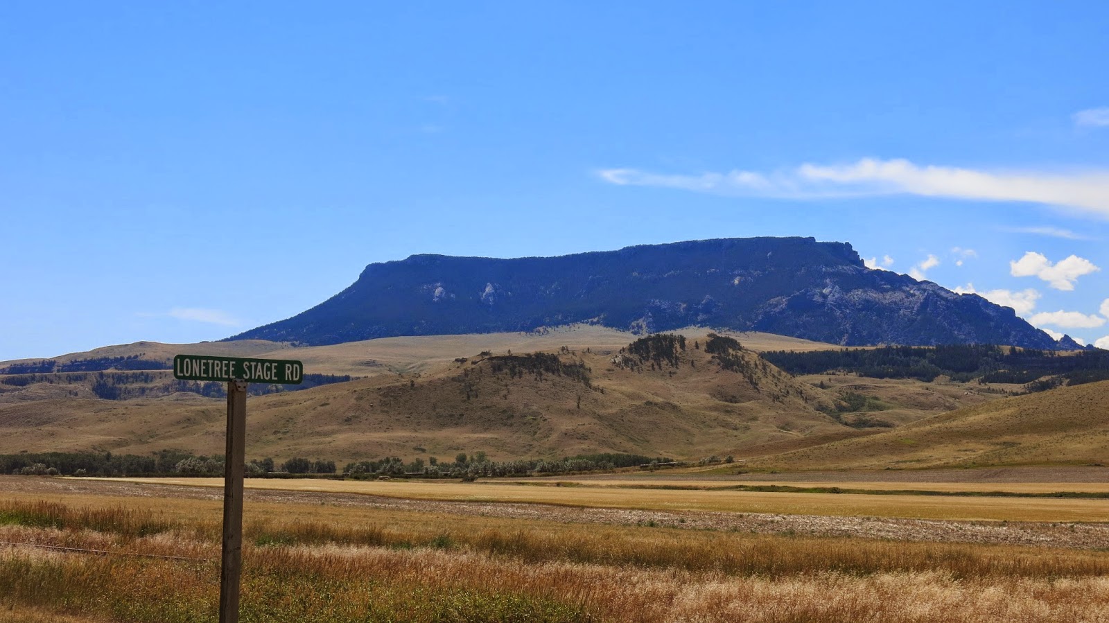

Looking north to Geraldine MT.


South to Square Butte.
The next town on the line is....


Just north of Geraldine is the end of tracks. Here looking south to Geraldine.

Old ROW equipment parked at the end of tracks.

In this picture, the rails end in the grass, I'm looking north, the route that used to take us to Great Falls MT, by rail.


Last look at Geraldine MT.

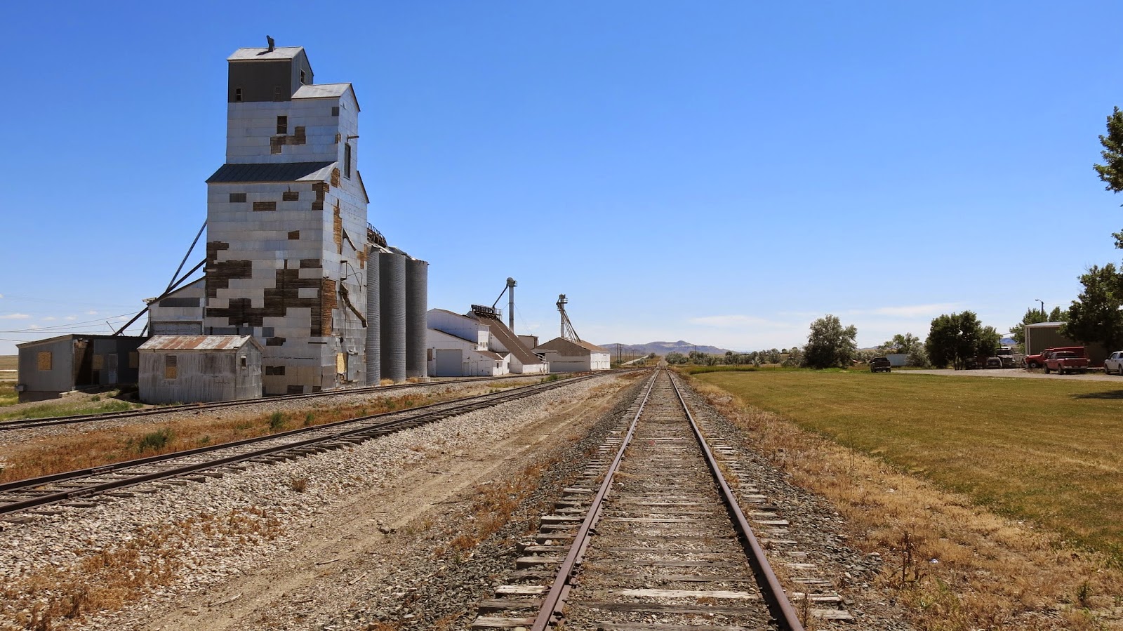
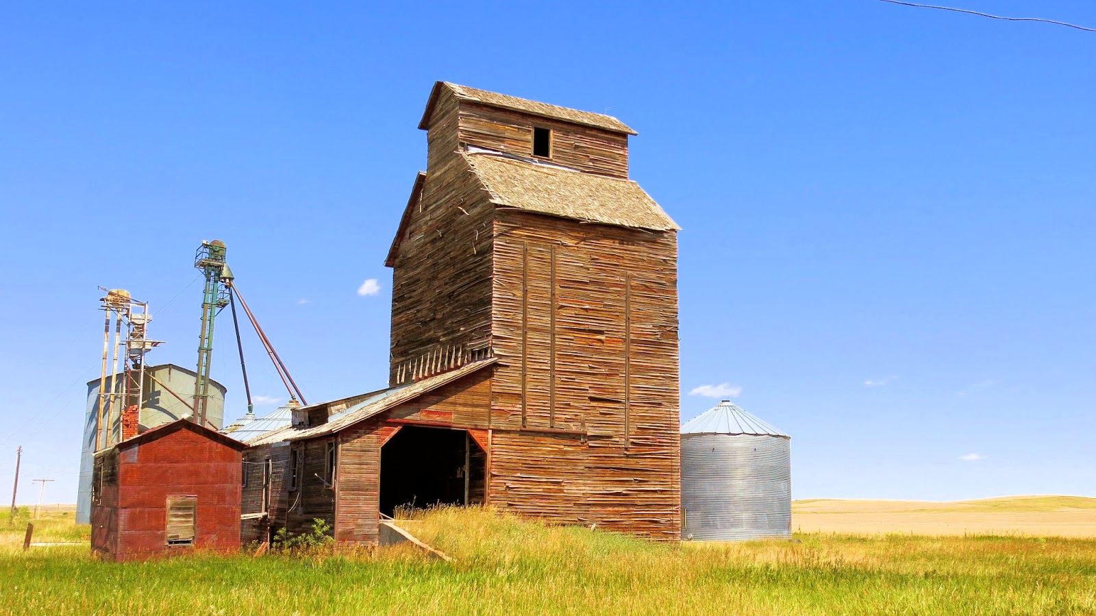
Grain elevator north/northeast of Highwood MT.


Highwood MT Elevators


From the elevators south towards Highwood.

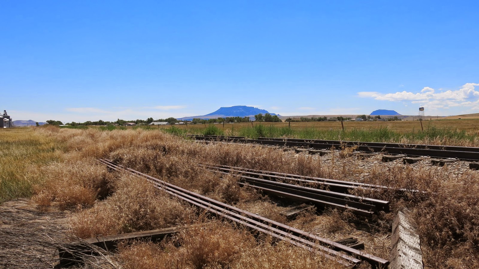
The rails crossed Hwy 228 here.

Hwy 228 crossing ahead towards Highwood.

The roadbed looking toward northwest from Highwood.
Grain Elevator where the roadbed crosses Whiskey Flat Road at Waltham MT. There is no real town here, only the memory.

Driving down the ROW from Whiskey Flat Road towards Lacey Tunnel.


Looking towards Lacey tunnel, a gate prevents me from going any farther.

Looking back towards Whiskey Flat Road.

We drive up and along the hillside, suddenly the Amphitheater tunnel comes into view.

The daylighted Amphitheater tunnel.

The Lacey Tunnel.

The Lacey Tunnel in the 1930's.

Next we hike to.......

Belt Creek Tunnel #5


Belt Creek Trestle looking west towards Red Coulee Tunnel #5


The east face of Red Coulee Tunnel #5.

Belt Creek Trestle looking east towards Belt Creek Tunnel.


1930's photo from the same location.


Next we walk through Red Coulee tunnel, it is an "S" shaped tunnel.

Looking east from the west face, you can see the curvature.


Grain loadouts between Red Coulee Tunnel and trestle.

The phone box still remains.

Grain loadouts between Red Coulee Tunnel and trestle.


Red Coulee Trestle


The ROW looking towards Great Falls

A last look at Red Coulee Trestle.

End of rails on Malmstrom AFB, looking east, across several miles of grain fields is Red Coulee Trestle, Highwood, Geraldine, Square Butte, Coffee Creek, Denton and Lewistown.


Looking west towards Great Falls and Falls Yard.

The crossing at the coal plant, looking west. The turnout with the dead lead was once a team track that served the base. More on this on my other post
coming soon.

East

The crossing looking east on 57 Street North.


The crossing looking east on 57 Street North.

West towards the CHS elevator, and the old Milwaukee Road wye breaks off to the left and served the Great Falls Meat Co. (Milwaukee Road Archives)


Looking east/southeast towards Fairfield MT


The wye ends here, directly behind me is 57th Street N. The track panels that used to cross the street were cut up and dragged to the center of the wye.


Sorry for the low December Montana sun, this was around noon!
By the way, I took ten step up the left leg and spooked up two sharptails. I had a flashback of hunting with my Dad and his good friend Tom, good memories.

...and those pesky shadows. Looking north towards the old hwy crossing towards where the meat company used to be. (some track still exists on the other side of the street)


A turnout and switch were dragged together to this point, still connected. The throwbar was twisted and resulted in the switch stand leaning at a 45 degree angle.


This industry track still exists of the 38th street yard.

The rails end here at the 38th Street crossing. Looking east, this is the location of "Falls Yard".


Falls Yard with the CHS Grain elevator in the distance, looking east toward Malmstrom A.F.B.

The "ditch" at the General Mills elevator looking east towards Falls Yard and Malmstrom A.F.B. The rails end "again" just under the overhead bridge in the distance. They start again at 38th Street crossing as mentioned above.

From the same spot looking west at the 25th Street overpass. From the sign on the track west the rails are still used by BNSF to switch the industries in town.


Looking west towards the 15th Street crossing. Once the track makes the crossing it deviates onto the BNSF (formerly GN) rails through the golf course and Gibson Park. The Milwaukee roadbed ran alongside the the GN railbed, and is now the "Rivers Edge Trail".

Looking east towards General Mills. It's interesting how the roadbed is also used as an vehicle alley.

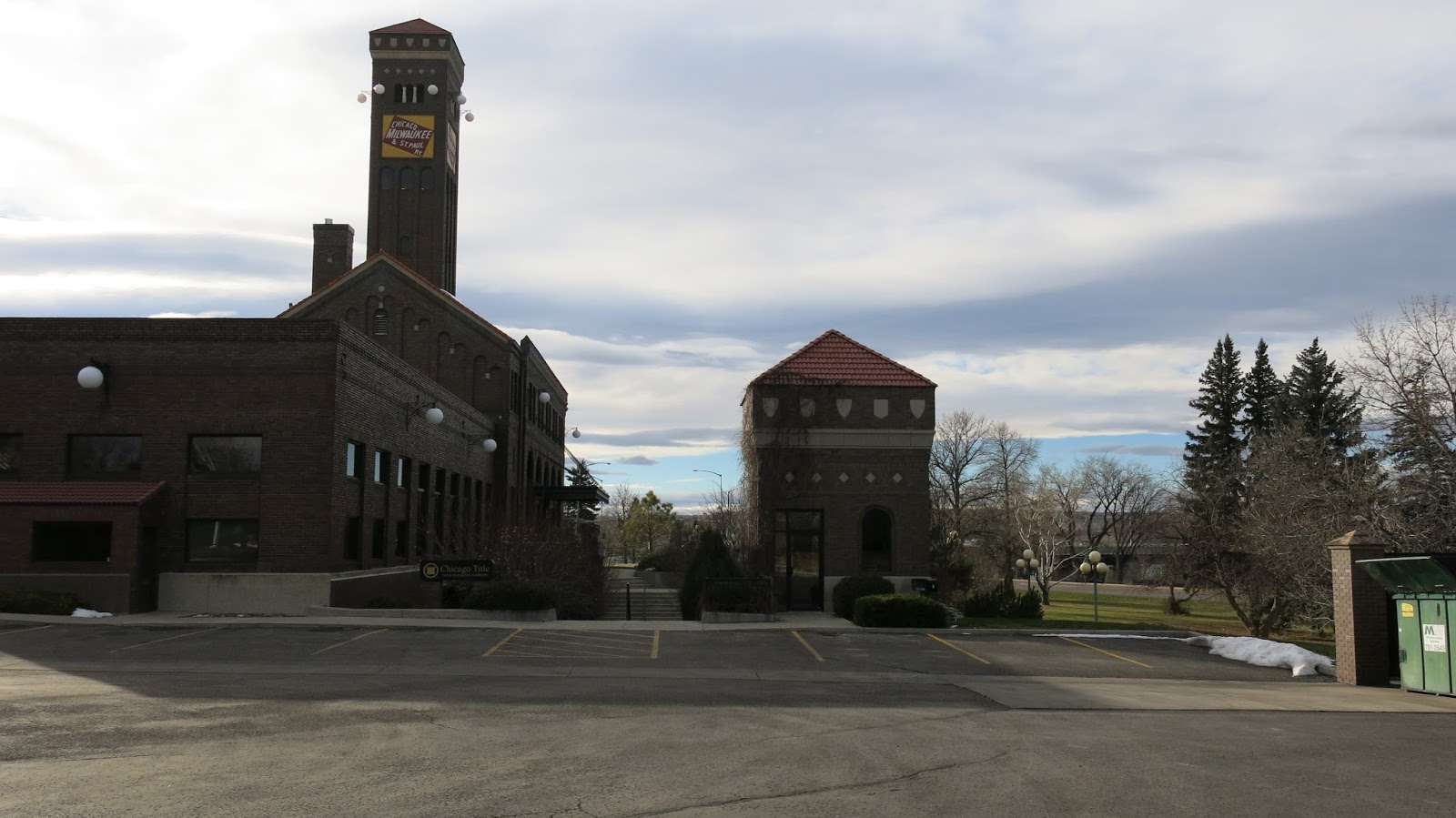
Looking east towards the 12th Street crossing, with the Milwaukee Station directly behind me.
The roadbed looking east/south east.
The beautifully preserved Milwaukee Road depot in Great Falls. There were plans to make this the second transcon to the Pacific, from Terry MT, connecting through Winnett MT (the far east branch of the northern Montana line, through Lewistown/Great Falls extending down the Hwy 200 corridor to Ovando Montana, down the Big Blackfoot River into Bonner (Milltown) and connecting to the original transcon on the south side of the Clark Fork river. The would eliminate the large swing to the south through Harlowton, Three Forks, Butte and Deer Lodge. I assume for the fall grain trains and passenger trains not having to stop in those cities.


The Missouri River crossing along Central Avenue. From here, the Milwaukee Road continued NW to Choteau MT, ending in Agawam MT, at a grain elevator, and a wye.


The ROW going up the valley a few miles from the intersection of HWY 200 and HWY 89 to Fairfield MT.

Looking North/Northwest where the line came in Fairfield from Great Falls. Now served by the BNSF that uses the MILW trackage from the old interchange at Eastham Junction shown below.

Looking back towards Great Falls.

Looking east/southeast towards Fairfield MT


The GN, then BN and the Milwaukee Road shared trackage into Choteau beginning here at Eastham Junction.


Choteau MT.


The Milwaukee Road N.M.D. branch to Agawam is now a private drive for a few hundred more feet as it branched off to the right here.


The Agawam Elevators

The end of the Northern Montana Division was this wye just past the elevators, if you look closely you can still see the roadbed along that fence up by the modern round silos and the single tree.


This line was built to capture the enormous grain loads that come out of the Golden Triangle, and the hopes were to connect this line to the Big Blackfoot branch that comes up the river from Milltown MT. This was planned on being the second mainline to the coast, but it never panned out as the first bankruptcy took hold on the "Resourceful Railroad".
I hope you enjoyed the journey.
Thanks for posting these pics.
ReplyDeleteFirst off, I have to commend you on the terrific work you have documented here!
ReplyDeleteI am writing in order to obtain permission to use your image (with proper credit given of course) of the Highwoods (grain elevator image) in a local-regional publication on Montana’s natural history. We specialize in small print runs of locale specific history titles and would love your image to accompany the chapter on island ranges.
I appreciate your consideration.
Gratefully,
Artie Crisp
Commissioning Editor l The History Press
ph: +1 843.577.5971 x239 and fax: +1 843.577.6712
www.historypress.net I www.arcadiapublishing.com
First off, I have to commend you on the terrific work you have documented here!
ReplyDeleteI am writing in order to obtain permission to use your image (with proper credit given of course) of the Highwoods (grain elevator image) in a local-regional publication on Montana’s natural history. We specialize in small print runs of locale specific history titles and would love your image to accompany the chapter on island ranges.
I appreciate your consideration.
Gratefully,
Artie Crisp
Commissioning Editor l The History Press
ph: +1 843.577.5971 x239 and fax: +1 843.577.6712
www.historypress.net I www.arcadiapublishing.com
What beautiful ghostly photos.
ReplyDeleteThis is wonderful. I love it..I would like more history on this. That are the metal bars Hanging outside tunnels) used for?
ReplyDeleteThey are referred to as "tell tails", before air brakes brakemen would on the top of the freight cars listening to the engineer's for the signal for them to apply brakes on the individual freight cars, these were design to hit the brakeman to warn the to get down, there's a tunnel coming.
ReplyDeleteLoved looking at your photos,my Father worked and we lived in all these places, Dan Hildahl, he was a section foreman later a General foreman later ran a large gang. My Grandfather lived in the section house for years in Great Falls, where the coca cola company built a factory. When I was 2 my parents lived in the old coaldoc house in Great Falls. We lived all over Montana, also Avery and St. Maries Idaho. I miss the wide open spaces. My brother was a brakeman for the Milwaukee.
ReplyDeleteSadly access to Red Coulee and Belt Creek trestles along with any tunnels there is now gated off with large "no trespassing" signs on it, this is as of today August 6, 2017. Went to take a look out there today with my father in law who lives in Belt.
ReplyDeleteSadly access to Red Coulee and Belt Creek trestles along with any tunnels there is now gated off with large "no trespassing" signs on it, this is as of today August 6, 2017. Went to take a look out there today with my father in law who lives in Belt.
ReplyDeleteThat is sad Eric, its a beautiful area, and I figured it was only a matter of time. I'm glad I got there when I did.
ReplyDeleteThis comment has been removed by a blog administrator.
ReplyDelete